.jpg) Mette-Sophie, a Norwegian aid worker accompanied me on one trip in January 1996 into the Hindu Kush. She was on cross country skiis and I used traditional skii's with touring bindings. Photo: Bob McKerrow
Mette-Sophie, a Norwegian aid worker accompanied me on one trip in January 1996 into the Hindu Kush. She was on cross country skiis and I used traditional skii's with touring bindings. Photo: Bob McKerrowNo foreigners had climbed in Afghanistan since the Soviets arrived in late 1978. I had heard about the passes and valleys strewn with land mines so it was with some trepidation I embarked from Kabul in October 1994 on what was probably the first expedition into the Hindu Kush for at least 17 years. I travelled with two British climbers, Ian Clarke and John Tinker, to the Chamar valley for an attempt on Mir Samir, a peak made famous by Eric Newby in his book, A Short Walk in the Hindu Kush.
John Tinker (right) and I at on one of our camps in the Chamar valley on the way to Mir Samir. Photo: Ian ClarkeTinker was fresh off an ascent of Everest by a new route on the north side and Clarke was head of a British Mine clearance organisation (Halo trust) in Afghanistan and was a necessary companion as the area had received large amounts of small scatterable mines, dropped from Soviet aircrafts to prevent the freedom fighters crossing the mountain passes. Our safety was dependent on his knowledge of mines and where battles had taken place. Tinker and Clarke attempted an unclimbed face on Mir Samir and got surprising high considering the unseasonably soft snow that had fallen. While the others were attempting Mir Samir, I climbed an unnamed peak around 5000 metres and looked over to the enticing mountains of Nuristan, formerly Kafirstan. As I sat on this probably unclimbed, and unnamed peak, I thought to myself " this is skiing country and what huge ptential."
. It was this trip with Clarke and Tinker that gave me the confidence to venture out on further climbing and skiing trips.
.jpg) On skiis in the Hindu Kush, near the Salang Pass. Photo: Bob McKerrow
On skiis in the Hindu Kush, near the Salang Pass. Photo: Bob McKerrowFrom 1993-96 when I lived in Kabul, on Friday, the only day off during the week, it was possible to climb among the various 4000 metres peaks in the Paghman range from where you get spectacular views of the Hindu Kush and Hazarajat area. Climbing 4000 metre peaks in a day made living in Kabul a joy. Also for the enthusiastic skier, a two hour drive takes you to the Salang Pass at 3,878 metres an excellent ski-mountaineering area. My good friend Ian Clarke the mine clearance expert gave the opinion that when the area is likely to have land-mines, if it is covered with snow, and you are on skis, it is almost impossible to trigger of a mine as the body-weight is evenly distributed. Clarke did a lot of telemark skiing in the area between 1993 and 1995 in the Salang Pass are before taking up a ski-instructors job at Cadrona, near Wanaka, for the New Zealand winter of 1995.
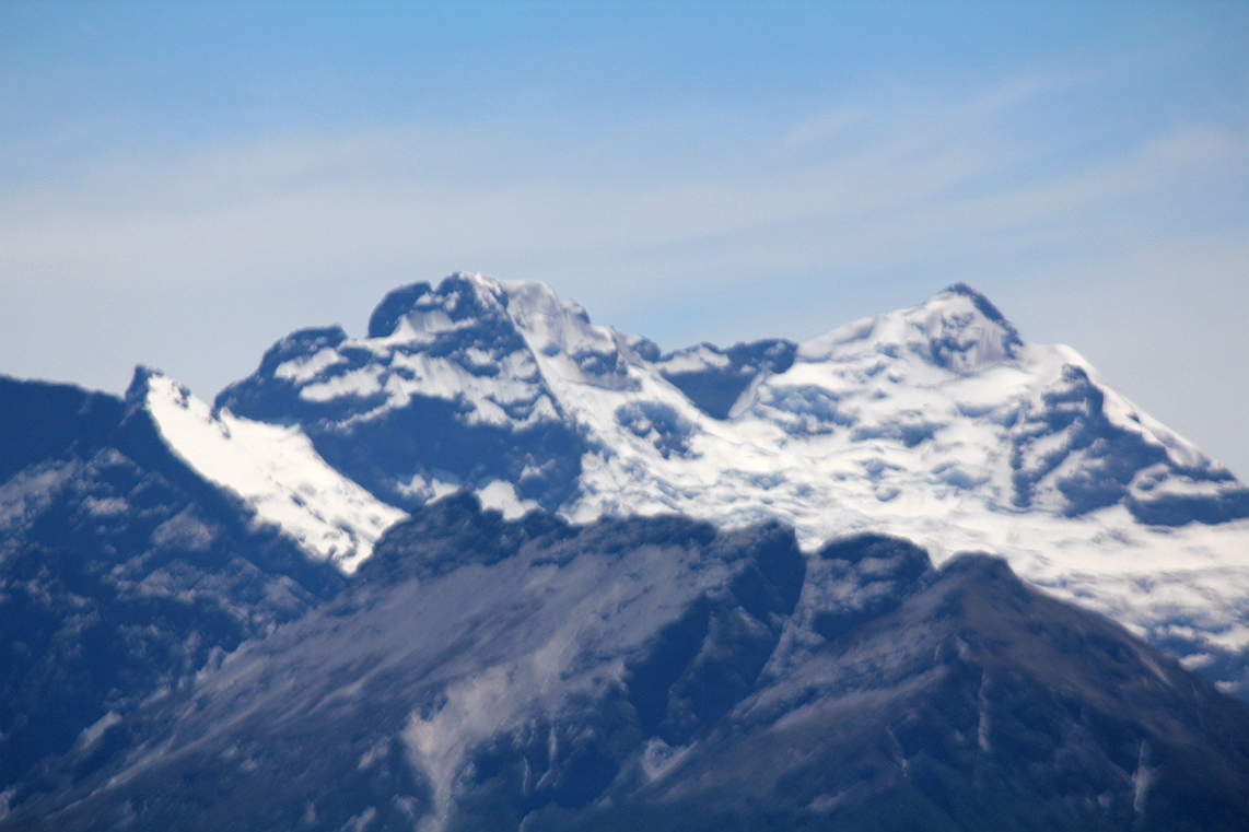
.jpg) So in 1995, I started skiiing in the Hindu Kush, not far from the Salang Pass, which was an hour and a half from Kabul. Above on skiis with the mighty Hindu Kush behind me. Photo: Bob McKerrow
So in 1995, I started skiiing in the Hindu Kush, not far from the Salang Pass, which was an hour and a half from Kabul. Above on skiis with the mighty Hindu Kush behind me. Photo: Bob McKerrow.jpg) Mette-Sphie on her cross country skiis in the Hindu Kush. Photo: Bob McKerrow
Mette-Sphie on her cross country skiis in the Hindu Kush. Photo: Bob McKerrow.jpg) Good snow conditions and a wonderful mountain backdrop, the mighty Hindu Kush: Photo: Bob McKerrow
Good snow conditions and a wonderful mountain backdrop, the mighty Hindu Kush: Photo: Bob McKerrow.jpg) Mette Sophie skiing down from the Salang Pass. January 1996. Photo: Bob McKerrow
Mette Sophie skiing down from the Salang Pass. January 1996. Photo: Bob McKerrow.jpg) The author, Bob McKerrow, skiing near the Salang Pass. Photo: Bob McKerrow
The author, Bob McKerrow, skiing near the Salang Pass. Photo: Bob McKerrowLast week I came across this article in the Guardian written by Jon Boone
guardian.co.uk, Tuesday 27 April 2010 and I was delighted that commercial skiing may soon become possible in the Hindu Kush at Bamiyan.
 The Bamiyan valley offers 'challenging skiing' reckons its first ski tourist after some hairy moments involving avalanches. Photograph: Chad Dear
In a classroom just a few hundred metres from the towering niche that once housed a giant Buddha statue, someone has pinned up a poster detailing the attributes of a good ski guide: optimistic, articulate, patient, reliable, active, cheerful, punctual and extroverted.
Sitting around a table in the middle of the room, the 10 young men who hope to become Afghanistan's first ski guides are being taught how to avoid avalanches, and the importance of taking enough food and water on trips up the snow-capped mountains that loom over the town of Bamiyan.
They have all the poster's key attributes in spades. Indeed, it's hard to think of a more agreeable bunch of enthusiastic young men, who chatter in excellent English. The only problem is the one characteristic they all lack: the ability to ski.
Last week, they had their first taste of the rapidly melting spring snow, out on the slopes of the stunning Koh-e-Baba mountain range. Their motley collection of borrowed and secondhand skis had been carted up the lush valley on the back of a donkey. The rookie skiers had ignored the classroom guidance to layer up, and hit the slopes wearing jeans and fake designer tops. Soon they were shivering.
They had just half a dozen pairs of skis, two pairs of which were borrowed from an American couple, Chad Dear and Laurie Ashley, ski consultants who believe central Afghanistan has some of the best "outback skiing" in the world. The shortage of equipment is a problem, and the mix of Telemark and alpine skis had been partly supplemented by a few pairs of "bazaar skis", lethal wooden planks knocked up by enthusiastic local carpenters. With the bindings little more than a few leather straps and the undersurface wrapped with metal, the overall effect is terrifying, as I discovered when I tried them.
"Jon, you've never done this either!" was the crushing verdict of Abdullah Mahmood, a 25-year-old novice skier, after he had watched me flounder around for a traumatic 10 minutes during which I wondered whether, despite decades of skiing experience, the sport was finally about to claim a broken leg from me.
These are the deeply humble beginnings out of which Bamiyan, an overished but heart-stoppingly beautiful province, hopes to develop a robust ski industry. There is serious weight behind the plan to encourage winter "ecotourism" here, including the province's governor, the Aga Khan Development Network and the New Zealand government (the country has troops in the province).
Dear, a development worker from Montana, says that in a few years' time Bamiyan could boast ski-rental businesses (which will probably rely, at least to start with, on the charity of the big ski manufacturers), a nursery slope with a simple tow-lift to drag beginners to the top, and maybe even some heliskiing. To start with, it is hoped that a mix of Afghans and foreigners working in Kabul will help pump-prime a ski industry, after which Bamiyan will be ready for the world. "We hope that people in Europe and the US will put it on their five-year wish list," Dear says.
He and Ashley are currently spending several days a week exploring Bamiyan's unskied peaks, with the aim of publishing a guidebook later in the year giving adventure skiers some basic information on what the Koh-e-Baba range has to offer. And while it would be easy to be cynical about trying to establish skiing in a war zone, after spending a few days with Dear, Ashley and the would-be ski guides, I am soon swept up in their enthusiasm.
For a particular type of tourist, Bamiyan is quite a draw. But it will never appeal to those who like the chairlifts, restaurants and creature comforts of a European or American mega-resort. In Bamiyan, if you want to get to the top of slope you have to propel yourself, using Telemark skis where the ankle is free to move up and down and synthetic skins are attached to the bottom. It's the sort of old-school skiing that would have been familiar to skiers in the Alps in the 1950s: a day of gruelling ascent for perhaps just one or two runs back down to the bottom. But it's worth it, says Dear: "The terrain here is just fantastic in so many ways, and we have only been exploring the eight valleys that are closest to Bamiyan centre. There are literally thousands of opportunities for beginners and experts."
Dear thinks many tourists will elect to stay above the snowline for days, skiing over huge areas, overnighting in shelters used by farmers in the summer that could be converted into winter refuges. And it's a fair bet that Bamiyan's apres-ski scene will never boast beery Brits, downing glühwein at the bottom of the chairlifts as the sun sets over the mountains. Instead it's chai, and maybe some rice, naan and greasy meat on the roof of a farmer's house.
What Dear calls the "apres-tea" experience would be worth a holiday in itself. First of all, the scenery is extraordinary. Below the snowy peaks, farmers living in mud houses busily plough their fields with ox teams. The sense of time travel is only broken with the occasional sighting of a satellite dish, a sign that, after years of neglect, things are starting to pick up here. And that is the other benefit of skiing in Bamiyan – contributing much-needed cash to subsistence farmers in the high, isolated valleys of a poor and neglected province that could use all the help it can get. Not only were the famous giant Buddhas blown up by the Taliban in 2001; the fundamentalist militia was also responsible for massacres of the largely Hazara population (Afghanistan's most put-upon ethnic group).
Today Bamiyan is an island of security in a country where insurgency has spread like a virus, and the valley is Afghanistan's main (or rather, only) tourist attraction. Visitors don't come simply for the World Heritage site where the Buddhas used to stand, but also the lakes and extraordinary natural dams of Band-e-Amir. The young men who aspire to be ski guides already try to make ends meet by showing tourists the main sites in the summer.
But despite Bamiyan's considerable charms, the summer tourism market does not add up to much: last year its historic sites were visited by 1,560 Afghans and 756 foreigners (slightly down on 2008, probably because of disruption caused by last year's presidential election). Even those low numbers generates around $250,000 a year in the three hotels the tourist authorities have information on.
But Amir Foladi, manager of the Bamiyan ecotourism programme, wants to see that increase. He hopes that by 2015 the 116 hotel beds currently available will have increased to 1,000, creating at least 1,000 jobs. He expects 10,000 foreign visitors and 100,000 Afghans to come each year, generating around $5m for the valley, excluding income from drivers, restaurants and handicraft shops.
That's big money for Bamiyan, and it would make tourism its third major source of income, behind agriculture and mining. "It's all about getting Bamiyan ready, helping hotel owners improve their facilities, so that when we are ready to receive more tourists it will be the people of Bamiyan who benefit and not outsiders," says Foladi.
And the wind is in Bamiyan's sails, with various plans to make the valley more accessible. Currently there are two main land routes from Kabul: the slow but safe road via the Sibher Pass, which despite being only 200km [124 miles] takes a gruelling eight hours, or the relatively fast but potentially lethal four-hour road trip through Taliban territory to the south.
The Sibher Pass route, which takes travellers through some unforgettable landscapes, is currently being flattened and widened by hundreds of workers, most of whom were last week inexplicably wearing fluorescent orange Royal Mail jackets. When the road is finished and covered with asphalt, the whole journey should take less than four hours – a much more attractive proposition for weekenders from Kabul who want a few days' skiing.
The country's airlines are being lobbied to start commercial flights, which may one day land at a new airport out of town. That will replace the current dirt airstrip – among the hazards of flying into Bamiyan is livestock wandering on to the runway.
And it's just possible that Bamiyan may get its Buddhas back – although this is currently the subject of a debate among conservationists, over whether the statues should be pieced back together from recovered fragments, or rebuilt afresh. Foladi says he favours the reconstruction of one Buddha, leaving one empty niche as a permanent reminder of unhappier times.
But will Bamiyan ever become more than a summer destination, even with these improvements? Ken Adams, Bamiyan's first ever ski tourist, thinks so. A former ski industry worker in the French Alps, he is now a project manager for an NGO in Kabul. Paying just $30 a night for a hotel room, he skied for seven days in Bamiyan this spring. Despite some hairy moments involving avalanches, he reckons Bamiyan is the place for anyone who wants "some pretty challenging skiing".
"For everyone else, there is just the sheer amount of snow and a season that in a normal year should continue until late May or early June," he says.
The big unknown is whether Afghans will take up skiing in any numbers. Dear and Ashley say the locals, who are already fond of sledding on homemade yakhmolaks and other winter games, have been enthusiastic. With everything under snow for five months of the year, they could certainly do with more winter distractions, says Foladi.
And skiing is not totally unknown in Afghanistan. Afghans got involved in the sport back in the 1960s and 70s, when it was last popularised by foreigners. In those days Kabul's diplomatic classes headed for the slopes at weekends at a mini-resort close to the capital. The piste even had its own basic rope-tow and was serviced by restaurants, tea shops and even a sunbathing area for the foreigners. Various ski clubs, including one run by the ministry of education and another by Kabul University, raced against each other. With the Soviet invasion of 1979, and the national resistance that rose up to fight it, the area was soon seeded with landmines and became unusable.
Mohammad Yousuf Kargar first encountered skiing as a young boy when he saw a German employee of Siemens throwing himself down a hill in Kabul. He has kept the sport going, at least within his own family. Now the national football team coach, Kargar tested the slopes of Bamiyan for the first time this winter. But he believes Bamiyan is still too far away from Kabul to be the focus of a skiing rebirth. Instead he takes his family to the Salang, a mountain pass north of Kabul. "The government really needs to take a strong decision to redevelop the old piste outside Kabul," he says. "In the meantime I am taking my family in the Salang because I don't want this sport to die in Afghanistan."
Even though Bamiyan is so untouched by violence that it feels like another country, Dear's hope that it might be ready for foreign visitors in five years seems optimistic at a time when the Taliban insurgency continues to strengthen.
Around the time I was embarrassing myself on the wooden skis, Kandahar city was rocked by a massive vehicle bomb parked outside a hotel. I was blissfully unaware of another terrible day in Afghanistan's second city as we trudged down muddy fields towards our apres-ski lunch. Later that day, a compound housing foreign contractors was attacked by an even bigger bomb.
Adams wonders whether it might be possible to fly into Kabul airport and then transfer directly on to a Bamiyan flight – essentially isolating the province from the rest of the country as far as foreign tourists are concerned. But, as Dear says, Bamiyan can only remain a bubble for so long. "You've just got to have hope that things are going to get better in Afghanistan. If the country goes down, Bamiyan will go with it.


.jpg)

.jpg)
.jpg)
.jpg)
.jpg)
.jpg)
.jpg)


