Tuesday, 17 November 2015

Born to Climb


I also took with me plenty of prenatal kits and vitamins to those places for the expecting women and those who had infants. We also tried to aware local women and young girls about possible human trafficking during that time Pasang Lhamu Sherpa Akita 


Having ascended Everest, K2, Nangpai Gosum II, Ama Dablam, and many other peaks in and outside Nepal, Pasang Lhamu Sherpa Akita has certainly earned her reputation as a successful Nepali summiteer. Now, as a result of her laudable mountaineering exploits and her self-effacing humanitarian and rehabilitation efforts following the April earthquake, particularly at Laprak in Gorkha, Sherpa Akita has been nominated for the prestigious National Geographic People’s Choice Adventurer of the Year 2016 award.

She talks about mountaineering, her nomination and the post-quake relief work with the Kathmandu Post’s Gaurav Pote. 

Before we begin would you tell us a little about yourself. I was in born in Khumjung village in Solukhumbu, but I grew up and completed by schooling in Lukla. Having been brought up in such close proximity to the mountains, my hobbies have always been related with trekking and mountaineering. Eventually I developed interest in travelling and exploring new places as well.

Will you also tell us how and when you started mountaineering? At the age of 18, I started my trekking courses and also began travelling. It wasn’t long before I took up mountaineering training and actually started climbing.

What is it about mountaineering that appeals to you the most? Growing up in the Lukla region,I saw countless tourists and mountaineers over the years. They would all travel for days to get to our small town, far away from their homes, and bravely go on to climb Everest. That somehow sparked the interest in me to be like one of them.

Mountaineering involves high risks; how do mountaineers deal with all the risks involved? High altitude mountaineering is by nature full of risks and dangers. We are constantly under the threat of avalanches and landslides. Rough weather and extreme temperatures put a physical and mental toll on the climbers. It’s easy to get fatigued and develop altitude sickness or catch frostbites. Then there’s the harsh terrain with crevasses and blizzards that torment us throughout our expeditions. At the end, all these risks reflect the terrible uncertainty that comes with the mountaineering profession, and we all try to minimise these risks by using our training, experience, and intuitions. Staying fit physically and taking precautions every step of the way is paramount as well.

Give us a brief rundown of some of the peaks that you have climbed so far. The first peak I scaled was the Everest back in 2007. Last year, I climbed K2 as a member of the first Nepali all-women expedition there, Nangpai Gosum II as a part of the first women expedition, and Ama Dablam with the first French-Nepali women expedition. Besides these, I have also scaled other Nepali, American and French peaks.

 Now, tell us about your nomination for the National Geographic’s Adventurer of the Year 2016. What were the criteria for selection? Every year, National Geographic short lists 10 extraordinary adventurers from the world over who push the limits of their respective discipline. One of them gets voted publicly by folks around the globe as the People’s Choice Adventurer of the Year. The reason for the nomination in the 2016 edition of this prestigious award is my engagement in the immediate and post-earthquake relief work in rural Nepali communities. I think it is a great opportunity to represent Nepal. I am really looking forward to that.

 And, how do you reckon people should go about voting for you? National Geographic announced the names of the nominees, including their video profiles and photographs,on their website last week. Even a simple Google search should take you there. Click the link to vote. The voting is open every day through January 31, 2016 and the announcement of the winner is scheduled in February 2016.Since it is a people’s choice category,it is really up to the voters to decide who wins. So, naturally, I would like to urge everyone to make a small effort to vote for me. That said, this nomination alone is quite prestigious but winning will surely help my cause even more.

 Can you talk about your humanitarian efforts after the earthquakes? I was caught in an avalanche near the Everest basecamp at the time of the first earthquake. I somehow managed to find my way to the basecamp and assist the people stranded there. The next day, I returned to Kathmandu and after making sure everything was secure at home, I started gathering relief materials including food, drinking water, mattresses, and tarpaulins and began mobilising them in and outside the Kathmandu Valley. We also travelled to Nuwakot, Dhadingbesi, Gorkha, Sindhupalchowk, Kavre, Dolakha, Manaslu, and many more rural places. I also took with me plenty of pre-natal kits and vitamins to those places for the expecting women and those who had infants. We also tried to raise awareness among local women and young girls about possible human trafficking during a time of crisis. And at a devastated Laprak, which is quite close to the epicentre, we constructed temporary shelters for the elderly.

 So, what keeps you busy these days? Apart from the on-going relief work and rural health camps, I am also currently involved in mountain guiding. And, what’s next for Pasang Lhamu Sherpa Akita? I’m going to continue mountain guiding and, on the side, focus on facilitating girls’ education, particularly orphans and those who come from underprivileged families affected by the earthquakes. 

Thanks to the Kathmandu Post for permission to run their article published: 17-11-2015 

Thursday, 12 November 2015

Ama Dablam - A fascination with a mountain for over 40 years


     Ama Dablam


I find the naming of mountains fascinating and in the Himalaya many mountains are seen as a Goddess, God or protector. Forty years ago when I first started trekking and climbing in the Nepal Himalaya, the peak Ama Dablam started a life-long fascination for me. While Sagarmatha, Chomolungma or Mount Everest is the Goddess Mother of the Universe, Ama Dablam appears protected by Sagarmatha, but has her own beauty and meaning. I think it is so fitting that the name fits in so comfortably with the current Yama Panchak festival in Nepal
The main peak of Ama Dablam is 6,812 metres (22,349 ft), the lower western peak is 6,170 metres (20,243 ft). Ama Dablam means "Mother's necklace"; the long ridges on each side like the arms of a mother (ama) protecting her child, and the hanging glacier thought of as the dablam, the traditional double-pendant containing pictures of the gods, worn by Sherpa women. Other writers extrapolate the meaning to "charm box, and is a special pendant worn by elder Sherpa women that holds precious items.”


More meaning is added to the ‘mana’ of the peak as it was first climbed by two New Zealanders I know, Mike Gill and Wally Romanes, along with Mike Ward and Barry Bishop on 13 March 1961 They were well-acclimatised to altitude, having wintered over at 5800 metres near the base of the peak as part of the Silver Hut Scientific Expedition of 1960-61, led by Sir Edmund Hillary. I know Mike and Wally personally and you couldn’t find two such humble people.
In all religions mountains are revered and one of my favourite quotes is: “I lift mine eyes unto the hills whence cometh my strength…

My Sherpa friend Neema from Kunde, on the3 Lumding La with Ama Dablam in the distant background. Photo: Bob McKerrow


Ama Dablam stands proud and can be seen from so many villages in the upper Khumbu. Photo: Bob McKerrow
Up in the clouds, Ama Dablam makes a brief appearance. Photo: Bob McKerrow

Wednesday, 11 November 2015

Extreme skiing at Aoraki/Mt. Cook National Park.

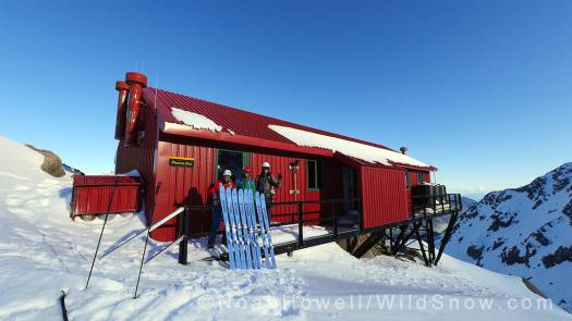
WildSnowNZ — Plateau Hut, Aoraki/Mt. Cook National Park


Post by WildSnow.com blogger  | November 3, 2015      
Noah Howell
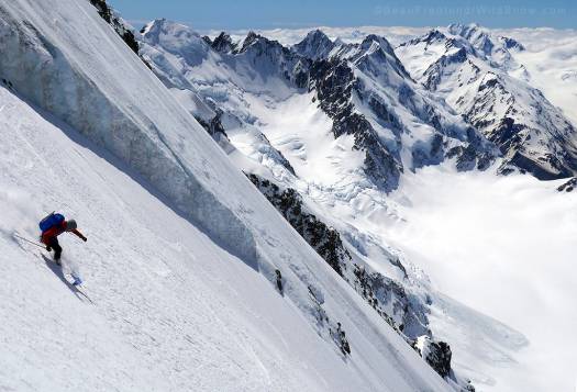
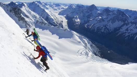
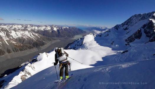
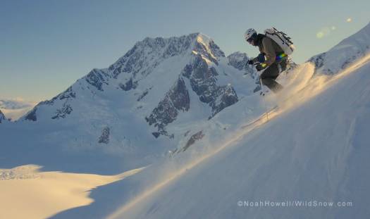
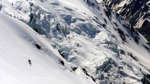
Billy Haas halfway down the enormous east face of Mt. Cook.
It’s been a good bit of time since Beau made his initial post. I was going to apologize for our delayed check in, but I won’t because we came to New Zealand to ski and that’s what we’ve been doing! For the past ten days we have been basing ski operations out of the Plateau and Kelman Huts in the Aoraki/Mt Cook National Park.
Upon arrival the weather cleared and we hit the ground skinning.
After countless emails between our crew we had all agreed beforehand that as a team we wanted to go big and ski steep. The plan was to shoot for the moon and then dial back objectives if needed and as conditions dictated.
The moon, or primary area of interest, was Mount Cook and the Tasman Glacier area. Mount Cook is the tallest peak on the island (3724m) and offers up some of the longest and spiciest technical routes in the Southern Alps.
In less than 24 hours after landing we met up with Beau and came up with a plan. We could walk in, but that would take time and energy and the weather window looked small, so we chartered a chopper into the Plateau Hut at the base of Mount Cook. Pretty reasonable at about $75 per person.
We came in hot and heavy with 5-7 days of food and lots of ideas. Well stocked and highly stoked! The weather was perfect and as we flew in we were immediately face to face with the east face. And the longer we stared at Mount Cook, it just stared right back unflinchingly.
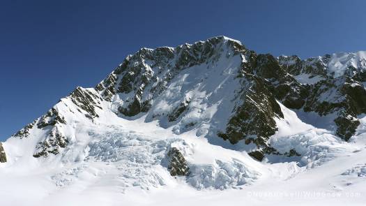
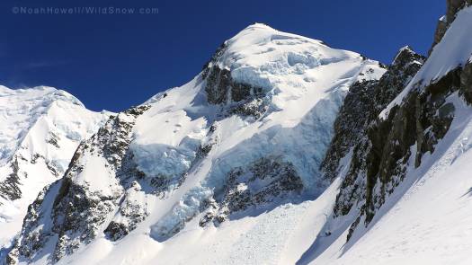
The east face of Mt. Cook.
We unpacked at the spacious and empty hut then quickly set out for a recon tour. Poking around on many aspects we found stable settled snow. The east face was the obvious route of choice (looker’s right side). It connected to the summit, was free of ice, and the snow looked really good.
Chamonix based skiers Tom Grant and Ross Hewitt flew in with us and were keen on skiing Cook as well. They were looking at the same objective, so we decided to team up and give the face a go the next morning.
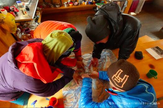
Map session in the Plateau Hut.
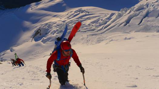
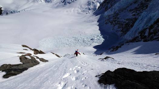
The alpine start put us on the lower face at dawn.
Early ups.
Early ups.
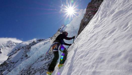
Enthusiasm quickly carried us up high. A little too high in fact. We missed our left turn and were forced to make a long and sketchy traverse over white ice. At least it was exposed. Ross was giving it all he had, but a cold forced him to turn back at this point.
Sharp tools and edges required.
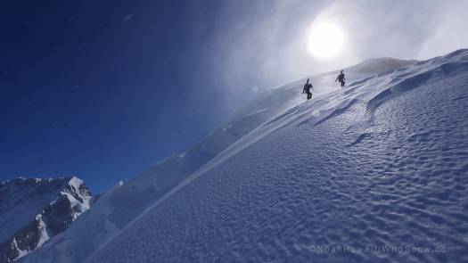
The slope pinched and forced us out onto a steep rib then we hiked the summit ridge to the tippy top. After only a day and a half in the country we went from flip flops to front points. Now we were on top of Mount Cook about to drop in on one of the largest and consistently steep faces any of us has ever touched, having made zero ski maneuvers in many months.
The summit ridge was icy and could have been skied but it would have been really slow, dangerous, and ugly. Sense easily won out over ego and we opted to down climb. Beau had never skied with Billy or Adam before this trip and none of us had skied with Tom. This could be reason for concern, but we all worked together seamlessly which was great to see and a bit of a relief on my part since I had assembled the team.
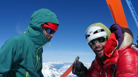
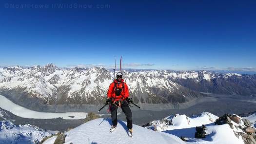
Adam and Billy on Mt. Cook summit.
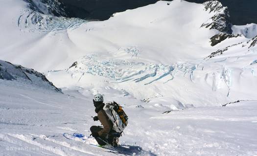
Six folks are a lot to manage on a slope, so we took our time and spaced out our turns. The snow was consistent and good.
Beau working the steeps up high on the face.
And as we got further down we opened it up. This steep skiing thing is a dream when everything lines up. It’s just really rare that everything goes this well.
Back down safe and sound we cooked up a fine meal and shook our heads at how fortunate our start to the trip was. The next day was windy in the morning so we loafed around and got a late start. The next best looking line was the east ridge of Mount Dixon. Not as tall a peak, but the route looked sporty. The line is the right hand ridge that then drops back left via a couloir in the rocks.
Mount Dixon.
Mount Dixon.
We brought all our sharp things on this trip and so far they were coming in more than useful.
Beau getting onto the entry couloir of Dixon.
The couloir held good snow as did the lower part of the ridge.
Steep couloir entry onto Dixon.
This changed as we got higher and we encountered some patches of the same ice we had found up high on Mount Cook. Luckily it was only in one section.
Glazed climbing up Dixon.
Sun’s out, guns out!
Guns ablazing.
Guns ablazing.
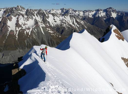
Turns off the top were chalky and fun on the mellow ridge. We worked our way through the ice with aggressive edging and side-stepping. Ice axes in hand just in case.
Off the top of Mount Dixon.
Things softened back up and we played down the featured ridge as the sun set. Each night at 7pm we received a call in with weather so we rallied to make the call, even though the thick kiwi accents are often tough to understand.
Beau lower down on Mount Dixon.
The ridge traverse into the exit couloir.
Adam Fabrikant entering the final pitch off of Mount Dixon.
I admit I came into this trip having done very little research. I figured Beau had it dialed since he has spent so much time here. And he does! I didn’t understand the vast network of nicely maintained and well equipped huts that dot these glaciated peaks, not to mention the ease of accessing them via fixed-wing or heli. The walk in or out isn’t out of the question either though it’s through some very rough moraine.
Three nights at the Plateau Hut and it started to feel like home. The remaining lines that interested us would need above optimal conditions. From what we had seen there was too much ice up high to lay it out there and so we decided to move on before we got ourselves into trouble.
Voile Team representing.
We loaded up our full kits and headed out for a new hut and fresh terrain. We skied around 2,000ft out the Freshfield Glacier in creamy corn. Our luck just continued to roll on!
Our massive corn run down the Freshfield Glacier.
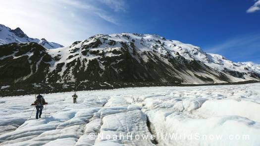
From here we crossed jumbled moraine and hit the dry glacier. This made for easy travel and we continued up the Tasman Glacier Valley for ten miles or so.
Many miles in the flats.
This is where I’m going to sign off and let Beau tell the next chapter of the story based out of the Kelman Hut. New Zealand has been an absolute dream so far!
WildSnow guest blogger Noah Howell was born and inbred at the foot of the Wasatch mountains. His skiing addiction is full blown and he’ll take snow and adventure in whatever form it takes. The past 16 years have been spent dedicated to exploring new ranges, steep skiing, and filming for Powderwhore Productions.

The Silk Roads - The New History of the World.

Are you fed up with reading history of the world from a Eurocentric perspective? I am thoroughly enjoying The Silk Roads - A new history of the world.by Peter Frankopan. I was in Delhi a few weeks ago and discovered this book at Bahrisons in Khan Market.
The sun is setting on the Western world. Slowly but surely, the direction in which the world spins has reversed: where for the last five centuries the globe turned westwards on its axis, it now turns to the east…
For centuries, fame and fortune was to be found in the west – in the New World of the Americas. Today, it is the east which calls out to those in search of adventure and riches. The region stretching from eastern Europe and sweeping right across Central Asia deep into China and India, is taking centre stage in international politics, commerce and culture – and is shaping the modern world.

This region, the true centre of the earth, is obscure to many in the English-speaking world. Yet this is where civilization itself began, where the world's great religions were born and took root. The Silk Roads were no exotic series of connections, but networks that linked continents and oceans together. Along them flowed ideas, goods, disease and death. This was where empires were won – and where they were lost. As a new era emerges, the patterns of exchange are mirroring those that have criss-crossed Asia for millennia. The Silk Roads are rising again.
A major reassessment of world history, The Silk Roads is an important account of the forces that have shaped the global economy and the political renaissance in the re-emerging east. 

Here is a wonderful review by in the Telegraph by  
Bettany Hughes 
Why do we travel? It is a question asked by historians, neuroscientists and anthropologists alike. Why are we driven, physically, intellectually and emotionally, to reach out beyond the horizon toward the unknown; to explore, connect and communicate? That query motivates Peter Frankopan’s splendid study, from prehistory to the present, of the Silk Roads: “the axis on which the world spun”.
The plural is important. Historically, the Silk Roads were a network, not a single highway. The geographical centre of this narrative is Asia Minor, Central Asia, the Caucasus, China and the Middle East; territories that met, traded with and domineered one another along arterial routes of communication. Frankopan freely admits to a boyhood enthusiasm for the region, a zone that for all its centrality remains suspiciously exotic on our world maps. 
Now director of the Centre for Byzantine Research at Oxford, Frankopan has a pressing reason to promote the Silk Roads’ history from cultural relegation. How shamefully we in the West have been caught in the 20th and early 21st centuries with our strategic trousers around our ankles, dunderheadedly failing to remember why the map of the Middle East is drawn with such straight lines. Our ancestors would have been horrified by today’s wilful ignorance. Ancient reports of the region (studded, admittedly, with some fantastical nonsense) would put many modern memos to shame. Tellingly, Frankopan includes some recently released diplomatic cables and US political briefings describing Afghanistan, Iraq and Iran that are cringingly callow, and exemplify the danger of living in what the late historian Eric Hobsbawm called the “permanent present”, ignorant of our past.
Frankopan’s study, subtitled “A New History of the World”, reminds us that one-way systems are a recent invention. Traffic – physically and culturally – typically runs two ways, and certainly did along the Silk Roads. The third century BC Indian emperor Ashoka, whose life was transformed by the Buddha, issued an edict in Aramaic with a parallel Greek translation. In the sixth century AD, a Chinese noble was buried with a silver ewer depicting the Trojan war. It was Chinese cloth “of inestimable value” that was draped in the early 12th century over the Ka’aba, Islam’s most sacred site, in Mecca. The descendants of slaves, trafficked along the Silk Roads, became the powerful Mameluke rulers of Egypt. The ferocious Ghaznavid and Seljuk empires, too, were established by Turkic slave-soldiers. It is heart-rending now to read a Chinese traveller’s description of a tranquil Syria in the seventh century AD: “Brigands and robbers are unknown, the people enjoy happiness and peace. None but illustrious laws prevail…”

We do history and the human experience a disservice if we follow a linear, teleological narrative through time, imagining it to be unidirectional or neatly boxed. Across time and space we are all connected; we all rise and fall. Globalisation might be voguish, but it is not new.
Frankopan tames this bear of an intercontinental narrative by ordering his chapters as a series of ideas: The Road of Gold, The Road to Hell, and so forth. Throughout, he relies on tight economic analysis: silk was, after all, not simply a luxury good but an international currency, too. The environmental impact of the silk trade is also intelligently explored – he raises new evidence, drawn from the polar ice caps, that the fall of Rome caused pollution levels to drop as smelting works across its empire fell into disuse. 
Recognising that the fringes of a cloth are as interesting as its fabric, Frankopan also spins off on to the threads of social history. The Black Death, for instance, had an impact on attitudes to fertility. Young women, newly empowered by social upheaval, could choose not to marry. Anna Bijns, an Antwerp schoolteacher, wrote in verse: “Unyoked is best! Happy the woman without a man!” The Silk Roads is peppered with other memorable details: in Venetian dialect, for instance, the word “ciao” originally meant “I am your slave”, while the conical hennin hat worn by European women from the 1430s directly imitated high fashion at the Mongol court.
Underlying the tightly researched history is a grander human truth. As a species, we are motivated by stories. The Silk Roads themselves are as much an idea as a reality: the term Seidenstrasse was only coined just over a century ago, by Ferdinand von Richthofen, the German geologist (and uncle of the First World War fighter ace). But continuous generations have told stories about these places, before the term Silk Road was coined. 
In antiquity, the Caucasus seemed a place of both promise and punishment – it was there that Jason sought the Golden Fleece, there that Prometheus was chained to the rocks. Medieval populations believed that Gog and Magog, the scourges of Israel prophesied in the Old Testament, had been locked up behind iron gates in the Caucasus by Alexander the Great. 
Many of these Silk Road yarns are an enjoyable cultural mash-up. Despite the fact that our own focus has often been damagingly parochial or focused on Greco-Roman antiquity, the East has long been woven through our national narrative. King Offa printed cod Arabic on one of his gold coins. During the 13th century, far-off Tartar ferocity in the Baltic interrupted the brisk herring trade, leaving the fish heaped up and unsold in British ports. Through Frankopan’s lens, even the Renaissance becomes less of a rebirth, more of a borrowing from the East. The glories of Greece and Rome, with which the johnny-come-lately civilisations of Western Europe associated themselves, had particularly flourished in the eastern Mediterranean, Anatolia and North Africa. The Silk Roads reminds us we are bit players in a grander drama; presenting the rise of the West as uninterrupted and inevitable is dangerously delusional.
This invigorating and profound book has enough storytelling to excite the reader and enough fresh scholarship to satisfy the intellect. My single cavil is that it could perhaps have described the physical reality of the Silk Roads themselves, many of which still exist, either as buzzing modern trade routes or archaeological remains. Maybe Frankopan will coax readers to step out on their own voyages of discovery, autodidacts walking the Silk Roads with their minds in both past and present.
To return to that question – why do we travel? Neuroscientists think they have the answer: our minds crave disturbance. It seems the brain works at its best when confronted with new experiences that fire up our synapses – travel may, truly, be mind-expanding. Our challenge as a species would seem to be to work out how we can experience the new without trampling on what has gone before. This epic book traces the cycle of human creation and destruction along the Silk Roads, now rich in billions of dollars’ worth of oil, minerals and labour. We must learn to pass along them without glancing greedily from side to side to gauge what we can gain. One alternative is to travel in the privacy of our own minds – an opportunity this charismatic and essential book amply provides.
Dr Bettany Hughes is writing a history of Istanbul. Her philosophy series Genius of the Ancient World is currently showing on BBC Four